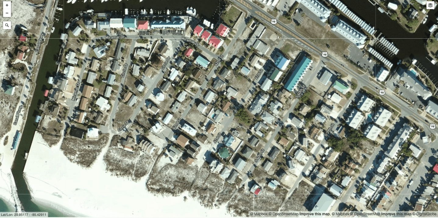
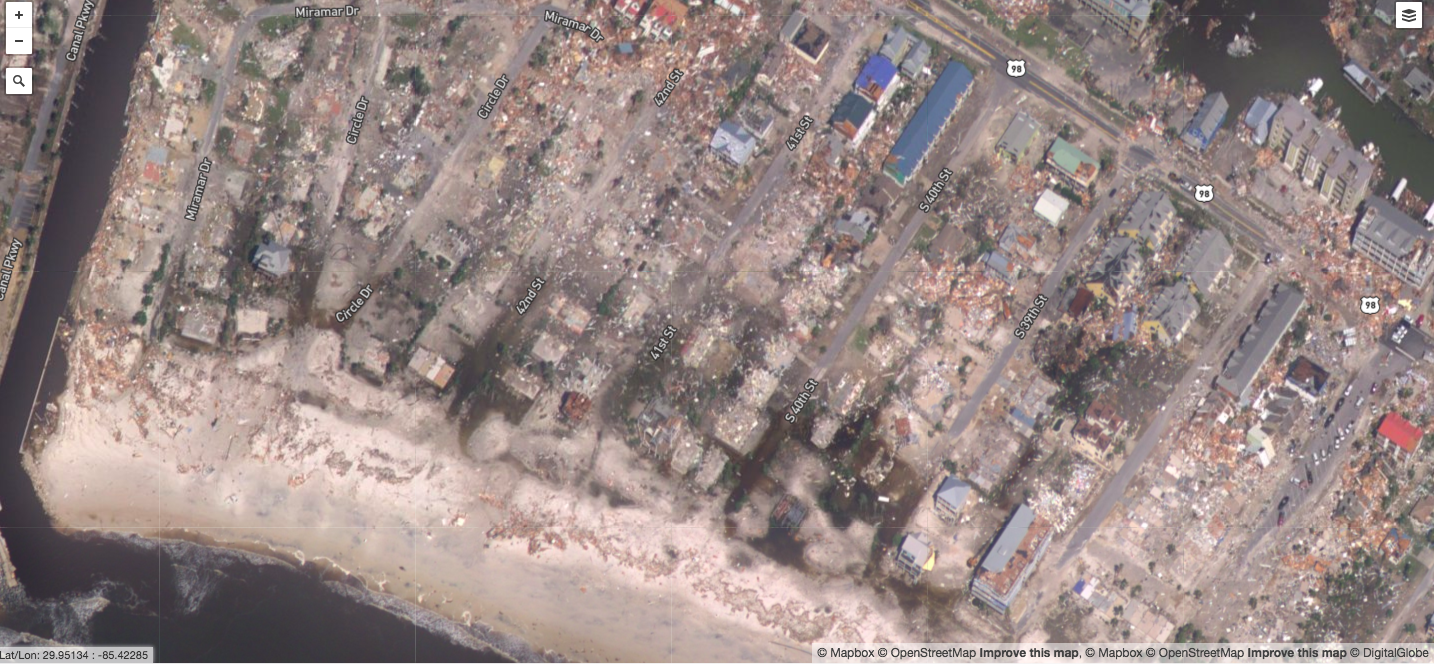
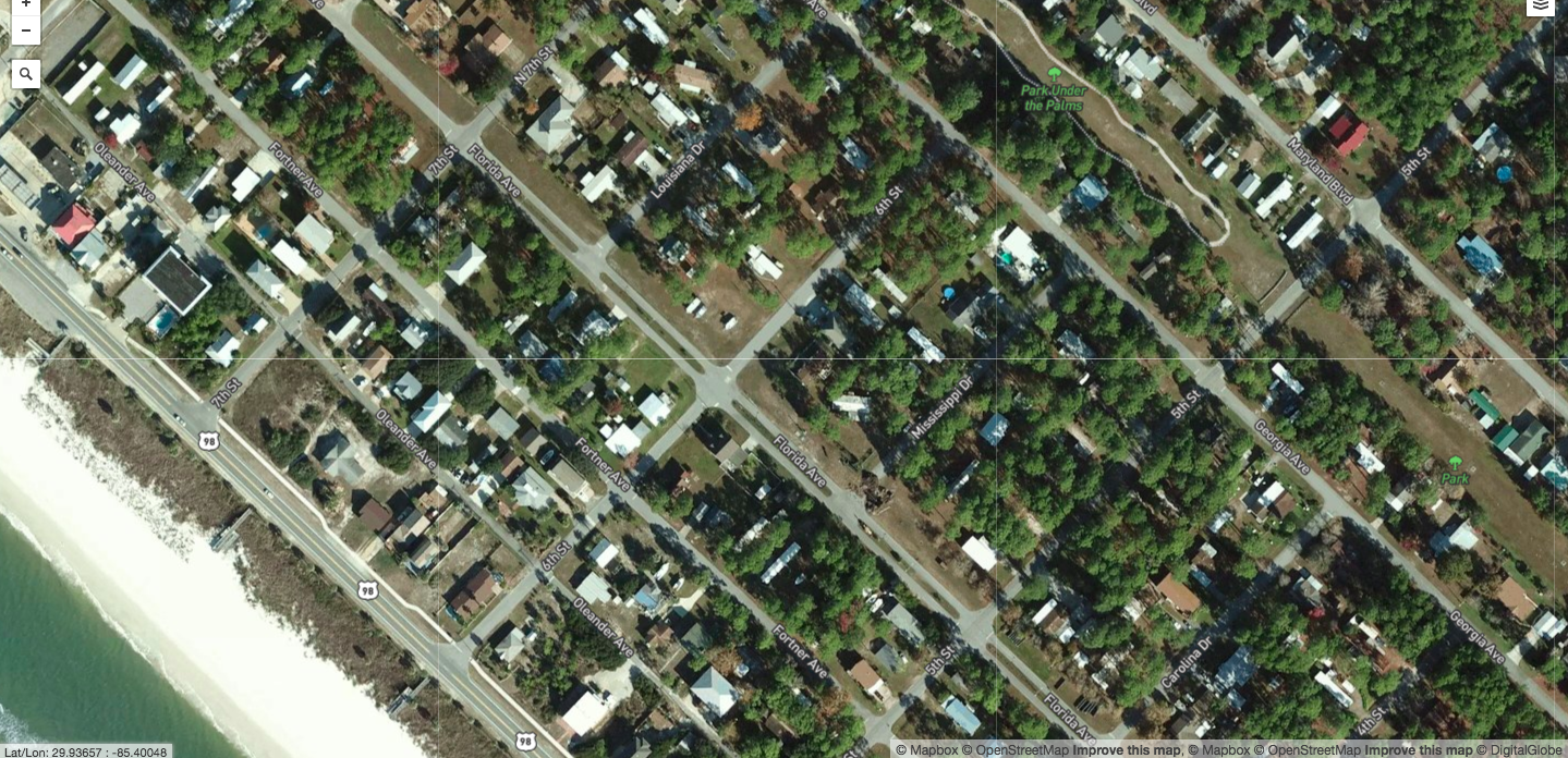
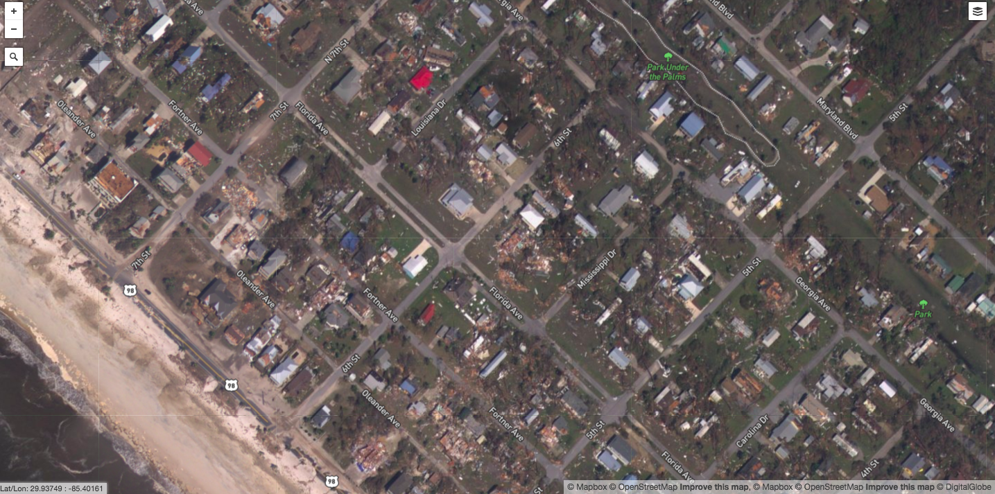
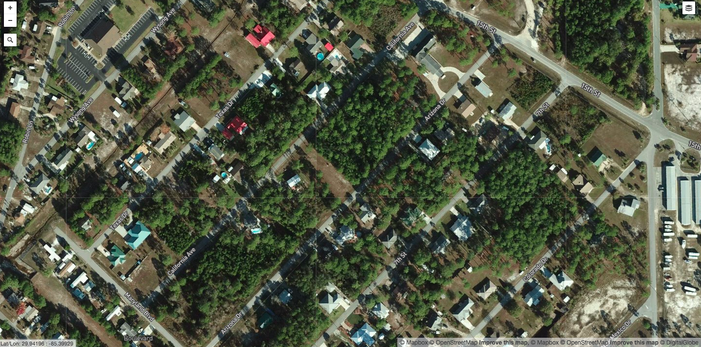
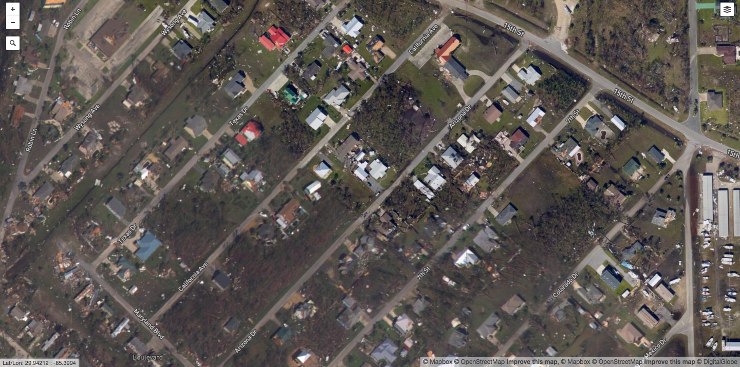
New aerial maps of the Florida panhandle are giving the first glimpse of the miles and miles of damage to the communities battered by Hurricane Michael.
The images, released by the National Oceanic and Atmospheric Administration, show severe damage in Mexico Beach, Florida, which took an almost direct hit from one of the most powerful storms to make landfall on the U.S. mainland. Before and after images reveal formerly lush green neighborhoods in the small community that have been completely wiped out – with most homes and businesses completely flattened or heavily damaged. The gaping holes where there were once hotels and houses put into perspective how powerful the 155 mph winds truly were.
In total, Boston-based Karen Clark & Company estimated $8 billion in insured losses due to the storm – which they said includes “privately insured wind and storm surge damage to residential, commercial and industrial properties and also automobiles.” KCC said that nearly half of the losses occurred in place in Florida’s Bay and Gulf counties.
As of Friday, a total of 11 people have died in storm-related deaths in Florida, Virginia, Georgia and North Carolina.
“Hurricane Michael is the worst storm that the Florida panhandle has ever seen, and one of the worst power storms to ever make landfall in the United States,” Florida Gov. Rick Scott said at a press conference Wednesday night. Just three major hurricanes have hit the panhandle since 1950.
Residents of Mexico Beach were forced to evacuate but state officials said 285 residents chose not to heed the mandatory evacuation order – leading the Florida National Guard to enter the area on Wednesday and rescue 20 survivors. As of Friday afternoon, rescuers are still digging through rubble and debris and assessing the damages to the town populated by 1,200 residents.
Below are aerial shots of Mexico Beach before and after Hurricane Michael made landfall on Wednesday.
More Must-Reads From TIME
- The 100 Most Influential People of 2024
- Coco Gauff Is Playing for Herself Now
- Scenes From Pro-Palestinian Encampments Across U.S. Universities
- 6 Compliments That Land Every Time
- If You're Dating Right Now , You're Brave: Column
- The AI That Could Heal a Divided Internet
- Fallout Is a Brilliant Model for the Future of Video Game Adaptations
- Want Weekly Recs on What to Watch, Read, and More? Sign Up for Worth Your Time
Write to Gina Martinez at gina.martinez@time.com